JavaScript is disabled for your browser. Some features of this site may not work without it.
| dc.contributor.author | Pearse, Geoffrey Eastcott (1885-1968)
|
|
| dc.contributor.illustrator | Eaton, Norman Musgrave, 1902-1966 | |
| dc.date.accessioned | 2009-04-02T07:16:49Z | |
| dc.date.available | 2009-04-02T07:16:49Z | |
| dc.date.created | 1928-08-19 | |
| dc.date.issued | 2009-04-02T07:16:49Z | |
| dc.description | 300DPI TIFF file scanned with Canoscan 8000f, edited using Photoshop v7. File dimensions: 1235 x 1701 pixels. Size: 6.02 MB. | en_US |
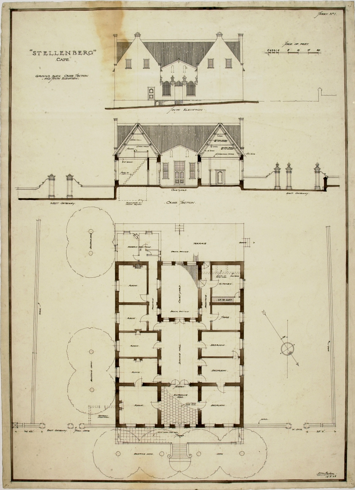
| dc.description.abstract | Ground plan, cross section and south elevation of the Stellenberg Cape Dutch homestead near Wynberg, Cape Town. Drawn by Norman Eaton for prof. Geoffrey Pearse's book "Eighteenth Century Architecture in South Africa" – see page 44 for a description, and Plate 55 for the drawing. The U-shaped thatched house features straight gables. | en_US |
| dc.format.medium | Ink drawing on tracing paper | en_US |
| dc.identifier.uri | http://hdl.handle.net/2263/9430 | |
| dc.language.iso | en | en_US |
| dc.relation.ispartofseries | ar001pap_pear.0010 | en_US |
| dc.rights | Complies with rights as specified by Collection Administrator | en_US |
| dc.subject | Cape Dutch | en_US |
| dc.subject | 18th Century | en_US |
| dc.subject | Eighteenth century | en_US |
| dc.subject | Stellenberg | en_US |
| dc.subject | Vogel, Jacobus | en_US |
| dc.subject | Rhenius, Johannes Izak | en_US |
| dc.subject | De Mist, Commissary-General | en_US |
| dc.subject | Drawings | en_US |
| dc.subject | Plan | en_US |
| dc.subject | Elevation | en_US |
| dc.subject | Country house | en_US |
| dc.subject | Section | en_US |
| dc.subject | Straight gable | en_US |
| dc.subject.lcsh | Architecture -- South Africa -- 18th century -- details | |
| dc.title | Stellenberg, Cape | en_US |
| dc.type | Plan or blueprint | en_US |